
Hello weirdo!

Random
Misi Gunung
List of mountains (DONE)
Trans Full C-Curve
#40mountainsin2018
#30mountainsin2017
#20mountainsin2016
#10mountainsinJapan
#10mountainsin2014
Links
Akmal | Ajiq
Julian.B | Kimmo.S
Monday, November 20, 2017, 9:57 PM
#10mountainsin2014
- Gunung Bunga Buah, Genting Highland, Pahang (1,430 meter)
- Gunung Brinchang, Cameron Highland, Pahang (2,032 meter)
- Gunung Irau, Cameron Highland, Pahang (2,110 meter)
- Gunung Angsi, Kuala Pilah, Negeri Sembilan (825 meter)
- Gunung Berembun, Terengganu (1,108 meter)
- Gunung Merbabu, Indonesia (3,145 meter)
- Gunung Batur, Bali, Indonesia (1,7,17 meter)
- Gunung Tahan, Pahang (2,187 meter)
- Gunung Datuk, Rembau, Negeri Sembilan (885 meter)
- Gunung Kinabalu, Sabah (4,095 meter)
I have a therapist, her name is NATURE.
Labels: 10mountainsin2014, hiking, misi2014, misigunung, mountain, outdoorwomen, wanitagunung
Tuesday, October 17, 2017, 3:33 AM
#30mountainsin2017
- Gunung Inas, Perak (1,454 meter)
- Gunung Rembau, Negeri Sembilan (884 meter)
- Gunung Gagak, Negeri Sembilan (807 meter)
- Gunung Kob, Kelantan (1,240 meter)
- Gunung Baha, Kelantan (1,450 meter)
- Gunung Ayam, Kelantan (1,500 meter)
- Gunung Che Tahir, Kelantan (1,430 meter)
- Gunung Saji, Kelantan (1,285 meter)
- Gunung Tera, Kelantan (1,555 meter)
- Gunung Nyelit, Kelantan (1,345 meter)
- Gunung Beirut, Kelantan (1,380 meter)
- Gunung Bar Gading, Perak (1,620 meter)
- Gunung Bongkok, Perak (1,344 meter)
- Gunung Banlok, Perak (1,412 meter)
- Gunung Ulu Kinjor, Perak (1,232 meter)
- Gunung Guling Gantang, Pahang (800 meter)
- Gunung Sempah, Pahang (1,205 meter)
- Gunung Rajah, Pahang (1,683 meter)
- Gunung Merapi, Yogyakarta (2,930 meter)
- Gunung Ciremai, Kuningan (3,078 meter)
- Gunung Argopuro, perbatasan Probolinggo, Situbondo, Bondowoso (3,088 meter)
- Gunung Rajah, Bentong, Pahang (1685 meter)
- Gunung Liang Timur, Behrang, Perak (1,933 meter)
- Gunung Liang Barat, Behrang, Perak (1,933 meter)
- Gunung Tumang Batak, Behrang, Perak (1,933 meter)
- Gunung Chondong Geliting, Behrang, Perak (1,825 meter)
- Gunung Kerjul, Ulu Slim, Perak (1,496 meter)
- Gunung Sanggul, Ulu Slim, Perak (1,451 meter)
- Gunung Tampin, Tampin, Negeri Sembilan (764 meter)
- Gunung Tampin Selatan, Tampin, Negeri Sembilan (734 meter)
May your dreams be larger than mountains and may you have the courage to scale their summits.
Labels: #30mountainsin2017, hiking, mountain, outdoorwomen, wanitagunung
3:08 AM
To more mountains!
Gunung Malaysia
- Gunung Korbu, Perak (2,183 meter)
- Gunung Gayong, Perak (2,173 meter)
- Gunung Yong Belar, sempadan Perak, Pahang, Kelantan (2,181 meter)
- Gunung Junction, sempadan Perak, Pahang, Kelantan (2,072 meter)
- Gunung Tebu, Terengganu (1,039 meter)
- Gunung Tok Wan, Selangor (675 meter)
- Gunung Bunga Buah, Pahang (1,430 meter)
- Gunung Brinchang, Pahang (2,032 meter)
- Gunung Irau, Pahang (2,110 meter)
- Gunung Angsi, Negeri Sembilan (825 meter)
- Gunung Berembun, Terengganu (1108 meter)
- Gunung Tahan, Pahang (2,187 meter)
- Gunung Kinabalu, Sabah (4,095 meter)
- Gunung Jerai, Kedah (1,217 meter)
- Gunung Baling, Kedah (420 meter)
- Gunung Rabong, Kelantan (1,538 meter)
- Gunung GAP, Selangor (1,183 meter)
- Gunung Ulu Semangkok, Selangor (1,394 meter)
- Gunung Ledang, Johor (1,394 meter)
- Gunung Yong Yap, sempadan Perak/Kelantan (2,167 meter)
- Gunung Bubu, Perak (1,974 meter)
- Gunung Tok Nenek, Pahang (1,916 meter)
- Gunung Chamah, Kelantan (2,171 meter)
- Gunung Ulu Sepat, Perak (2,161 meter)
- Gunung Hitam, Selangor (1,220 meter)
- Gunung Bintang False, Perak (1,526 meter)
- Gunung Bintang Selatan, Perak (1,560 meter)
- Gunung Bintang, sempadan Kedah, Perak (1,862 meter)
- Gunung Bintang Utara, Kedah (1,835 meter)
- Gunung Berembun, Negeri Sembilan (1,014 meter)
- Gunung Besar Hantu, Negeri Sembilan (1,462 meter)
- Gunung Nuang, Selangor (1,493 meter)
- Gunung Inas, Perak (1,454 meter)
- Gunung Datuk, Negeri Sembilan (885 meter)
- Gunung Rembau, Negeri Sembilan (884 meter)
- Gunung Gagak, Negeri Sembilan (807 meter)
- Gunung Stong, Kelantan (1420 meter)
- Gunung Kob, Kelantan (1,240 meter)
- Gunung Baha, Kelantan (1,450 meter)
- Gunung Ayam, Kelantan (1,500 meter)
- Gunung Che Tahir, Kelantan (1,430 meter)
- Gunung Saji, Kelantan (1,285 meter)
- Gunung Tera, Kelantan (1,555 meter)
- Gunung Nyelit, Kelantan (1,345 meter)
- Gunung Beirut, Kelantan (1,380 meter)
- Gunung Bar Gading, Perak (1,620 meter)
- Gunung Bongkok, Perak (1,344 meter)
- Gunung Banlok, Perak (1,412 meter)
- Gunung Ulu Kinjor, Perak (1,232 meter)
- Gunung Guling Gantang, Pahang (800 meter)
- Gunung Sempah, Pahang (1,205 meter)
- Gunung Rajah, Pahang (1,683 meter)
- Gunung Liang Timur (1,933 meter)
- Gunung Liang Barat (1,933 meter)
- Gunung Tumang Batak (1,933 meter)
- Gunung Chondong Geliting (1,825 meter)
- Gunung Kerjul, Ulu Slim, Perak (1,496 meter)
- Gunung Sanggul, Ulu Slim, Perak (1,451 meter)
- Gunung Tampin, Tampin, Negeri Sembilan (764 meter)
- Gunung Tampin Selatan, Negeri Sembilan (734 meter)
- Gunung Hulu Lenik, Kuala Kubu Baru, Selangor (1,150 meter)
- Gunung Kecil Hantu, Jelebu, Negeri Sembilan (1,354 meter)
- Gunung Hantu, Jelebu, Negeri Sembilan (1,241 meter)
- Gunung Gua Rimau, Kluang, Johor (889 meter)
- Gunung Belumut, Kluang, Johor (1,010 meter)
- Gunung Chemendong, Kluang, Johor (846 meter)
- Gunung Gapis, Raub, Pahang (1,106 meter)
- Gunung Jua, Raub, Pahang (830 meter)
- Gunung Tui, Raub, Pahang (1,397 meter)
- Gunung Kerunai, Gerik, Pahang (1,000 meter)
- Gunung Kenderung, Gerik, Pahang (1,223 meter)
- Gunung Behrang, Behrang, Perak (1,500 meter)
- Gunung Putung Asap, Kuala Kangsar, Perak
- Gunung Bubu West, Kuala Kangsar, Perak (1,647 meter)
- Gunung Bubu, Kuala Kangsar, Perak (1,568 meter)
- Gunung Shoid, Gua Musang, Kelantan (1,947 meter)
- Gunung Gerah, Perak/Kelantan (2,103 meter)
- Gunung Bilah, Perak/Kelantan (2,077 meter)
- Gunung Surian, Perak (1,827 meter)
- Gunung Kuar, Perak (1,772 meter)
- Gunung Aler, Perak (1,779 meter)
- Gunung Berhid, (1,930 meter)
- Gunung Charlie, Pahang/Perak (1,923 meter)
- Gunung 3 Boundaries, Perak/Pahang/Kelantan (1,805 meter)
- Gunung 6040, Pahang (1,840 meter)
- Gunung Anak Noring, Kelantan (1,889 meter)
- Gunung Noring Timur, Kelantan (1,861 meter)
- Gunung Suku, Cameron Highland, Perak (1,797 meter)
- Gunung Yellow, Cameron Highland, Perak (1,667 meter)
- Gunung Pass, Cameron Highland, Perak (1,587 meter)
- Gunung Bunting, Cameron Highland, Perak (1,240 meter)
- Gunung Tanggung, Cameron Highland, Perak (1,270 meter)
- Gunung Gandik, Cameron Highland, Perak (1,291 meter)
- Gunung Pasir, Seri Menanti, Negeri Sembilan (892 meter)
- Gunung Pulai, Kulai, Johor (654 meter)
- Gunung Lambak, Kluang, Johor (510 meter)
- Gunung Pulai, Baling, Kedah (620 meter)
- Gunung Mat Chinchang, Langkawi, Kedah (701 meter)
- Gunung Raya, Langkawi, Kedah (881 meter)
- Gunung Semanggol, Kerian, Perak (390 meter)
- Gunung Kuang, Kuah, Langkawi (420 meter)
- Gunung Perlis, Perlis (733 meter)
- Gunung Arong, Mersing, Johor (240 meter)
- Gunung Alai, Gerik, Perak (791 meter)
- Gunung Papulut, Gerik, Perak (726 meter)
- Gunung Pulut, Gerik, Perak (651 meter)
- Gunung Lentang Legong, Hulu Langat, Selangor (1370 meter)
- Gunung Berembun, Cameron Highland, Pahang (1840 meter)
- Gunung Peninjau, Ipoh, Perak (1058 meter)
- Gunung Jasar, Cameron Highland, Pahang (1,704 meter)
- Gunung Perdah, Cameron Highland, Pahang (1,576 meter)
- Gunung Ruil, Cameron Highland, Pahang (1,718 meter)
- Gunung Telapak Buruk, Negeri Sembilan (1,193 meter)
- Gunung Keriang, Alor Setar, Kedah (217.9 meter)
- Gunung Kerengga, Pedu, Kedah (243 meter)
- Gunung Bubu, Gerik, Perak (619 meter)
- Gunung Pupuk, Gerik, Perak (400 meter)
Gunung Indonesia
- Gunung Rinjani, Lombok (3,726 meter)
- Gunung Batur, Bali (1,717 meter)
- Gunung Merapi, Yogyakarta (2,930 meter)
- Gunung Merbabu, Yogyakarta (3,145 meter)
- Gunung Ceremai, Kuningan (3,078 meter)
- Gunung Argopuro, perbatasan Probolinggo, Situbondo, Bondowoso (3,088 meter)
Gunung Jepun
- Gunung Io, Nagano (9,055 kaki / 2,760 meter)
- Gunung Tsukuba, Tsukuba (2,877 kaki / 877 meter)
- Gunung Kita, Yamanashi (10,476 kaki / 3,193 meter)
- Gunung Nakashirane, Yamanashi (10,022 kaki / 3,055 meter)
- Gunung Aino, sempadan Shizoaka, Yamanashi (10,463 kaki / 3, 189 meter)
- Gunung Takao, Tokyo (1,965 kaki / 599 meter)
- Gunung Kobotoke-Shiroyama, Tokyo (2,198 kaki / 670 meter)
- Gunung Kagenobu, Tokyo (2,385 kaki / 727 meter)
- Gunung Jinba, Tokyo (2,812 kaki / 857 meter)
- Gunung Fuji, sempadan Shizoaka, Yamanashi (12,388 kaki / 3,776 meter)
Gunung Thailand
- Gunung Silipat, Betong (1,991 kaki / 607 meter)
P/S: This list will be updated from time to time. Till then, see you when I see you on track :)
The last word always belongs to the mountain.
Labels: hiking, indonesia, itraveltohike, japan, misigunung, mountain, outdoorwomen, wanitagunung
3:04 AM
#20mountainsin2016 (updated)
Since I'm stuck with Japan posts, I'll update on my #misigunung #misi2016 's progress here.
1. Mount Baling, Baling, Kedah (420m / 1377ft)
2. Mount Rabong, Gua Musang, Kelantan (1538m / 5047ft)
3. Mount GAP, Fraser Hill, Kuala Kubu Bharu, Selangor (1183m / 3868ft)
4. Mount Ulu Semangkok, Fraser Hill, Kuala Kubu Bharu, Selangor (1394m / 4558ft)
5. Mount Datuk, Rembau, Negeri Sembilan (885m / 2900ft)
6. Mount Ledang, Ledang, Johor (1276m / 4186ft)
7. Mount Yong Yap, Perak (2168m / 7110ft)
8. Mount Bubu, Perak (1657m / 6476ft)
9. Mount Tok Nenek, Perak (1916m / 6248ft)
10. Mount Chamah, Kelantan (2171m / 7123ft)
11. Mount Ulu Sepat, Perak/Kelantan (2161m / 7089ft)
12. Mount Black, Hulu Langat, Selangor (1220m / 4026ft)
13. Mount Bintang False, Perak (1526m / 5007ft)
14. Mount Bintang South, Perak (1560m / 5118ft)
15. Mount Bintang, Kedah/Perak (
16. Mount Bintang North, (1862m / 6020ft)
17. Mount Berembun, Negeri Sembilan (1014m / 3326ft)
18. Mount Besar Hantu, Negeri Sembilan (1462m / 4796ft)
19. Mount Nuang, Selangor (1493m / 4898ft)
20. Mount Stong, Kelantan (1422m / 4665ft)
11 mountains completed. Another 9 mountains to go!
**update : Completed all 20 mountains last year. Yeayyyyyy!
It was in those moments of loneliness that I found You.
Labels: 20mountainsin2016, hiking, malaysia, misi2016, misigunung, mountain
Friday, May 27, 2016, 4:08 PM
1. Mount Io (硫黄岳), Southern Yatsugatake, Nagano.

Mount Io / 硫黄岳 (2,760m/9,060ft) was the first mountain in the list. Mount Io is a stratovolcano mountain. It is one of the many peaks of Southern Yatsugatake mountain range located at the border of Chino and Minamimaki Prefecture, Japan. Southern Yatsugatake has 8 peaks (Mount Aka being the highest) while Northern Yatsugatake has 10 peaks (Mount Tengu being the highest).
I hiked with two of my new friends whom I knew from social media (the one I mentioned earlier in previous post, remember?), Anas (but I like to call him Nanas more, so I'll use Nanas in this post) and Sota-san. Well, being the random me, I was the one who asked Sota-san to hike together. And later when Nanas knew about it, he wanted to join us as well. Initially, Sota-san planned to hike three mountains, Mount Aka (the highest peak of Southern Yatsugatake mountain range), Mount Yoko and Mount Io. But due to bad weather, we only managed to hike Mount Io (also due to my inability to endure cold weather).
THE TRUTH : I lost the data once I updated iOS (oh screw you Apple!). So, this is basically what I remember. (sobs)
Sota-san and Nanas picked me up at 2AM at the guesthouse I was staying in Nakano. It took about 3 hours (more or less) to reach Yatsugatake-Chūshin Kōgen Quasi-National Park by car. We stopped at highway pit stop in the middle of the journey for Subh prayer. It was my first time seeing Japanese highway pit stop, and trust me, I was jakun. Haha.
Public transport instruction :
From Shinjuku Station, take the rapid train to Chino Station.
From there, take a bus to Minotoguchi Trailhead (美濃戸口).
Shinjuku→Chino Station → Minotoguchi Trailhead
2 hours 25 mins. (¥6,070) → 45 mins. (¥900)
I hiked with two of my new friends whom I knew from social media (the one I mentioned earlier in previous post, remember?), Anas (but I like to call him Nanas more, so I'll use Nanas in this post) and Sota-san. Well, being the random me, I was the one who asked Sota-san to hike together. And later when Nanas knew about it, he wanted to join us as well. Initially, Sota-san planned to hike three mountains, Mount Aka (the highest peak of Southern Yatsugatake mountain range), Mount Yoko and Mount Io. But due to bad weather, we only managed to hike Mount Io (also due to my inability to endure cold weather).
THE TRUTH : I lost the data once I updated iOS (oh screw you Apple!). So, this is basically what I remember. (sobs)
Sota-san and Nanas picked me up at 2AM at the guesthouse I was staying in Nakano. It took about 3 hours (more or less) to reach Yatsugatake-Chūshin Kōgen Quasi-National Park by car. We stopped at highway pit stop in the middle of the journey for Subh prayer. It was my first time seeing Japanese highway pit stop, and trust me, I was jakun. Haha.
Public transport instruction :
From Shinjuku Station, take the rapid train to Chino Station.
From there, take a bus to Minotoguchi Trailhead (美濃戸口).
Shinjuku→Chino Station → Minotoguchi Trailhead
2 hours 25 mins. (¥6,070) → 45 mins. (¥900)
 |
| The food order machine. You pay first, get the receipt and give it to the food stall worker. |
 |
| Their convenience store is to die for, everything's here. They have variety of food too. But Muslim cannot eat everything. Haha. |
 |
| Subh prayer. I bring my raincoat everywhere I go. It has multiple purposes, can be used as telekung as well as sejadah. |
 |
| Japanese highway pit stop |
Though I hike often and have like 3 years of hiking experience, I still could not get rid of the nervous feeling. It always gets me whenever I hike mountains I have never been to. I didn't know what to expect, what to feel, what to think. The unfamiliarity made you losing your mind. I told myself to calm down, just follow the flow, keep walking and rest if you need to. And I also told them about my hiking pace so they can estimate theirs. Hmmm, just like I expected, first mountain is always the hardest (cough*worst*cough).
We started hiking around 5.30AM from Minodo trail head. I do not have much information on the trail though, because I lost the log in my phone and I did not buy or take any maps of Yatsugatake mountain as I could not find any (actually more like I forgot to go to the office). Haha. Sorry. But here is a few information on the trails we used, roughly.
Minodo-guchi / 美濃戸口 (trail head) - Minodo Sanso - Kitazawa - Akadake Kosen (hot spring mountain hut) - Iodake (Mount Io) - Gyoujyagoya - Minamizawa - Minodo


After few hours trekking, I started to feel the coldness as the elevation increased. Cold weather is my ultimate weakness. I can endure steep trail, hiking for hours (I once hiked for 16 hours straight with heavy load before *cough*V1*cough) or walking under scorching sun. But not cold weather. I could not think straight when I hiked Kinabalu last year as it was too cold to handle (because it was raining the day before and the temperature dropped). So when Sota-san said it was not that cold, I thought a thin Uniqlo windbreaker would do me justice. Sadly, no (cry). The weather in Japan mountain area is still cold even in summer. And I learnt my lesson, in a VERY HARD WAY.


Minodo-guchi / 美濃戸口 (trail head) - Minodo Sanso - Kitazawa - Akadake Kosen (hot spring mountain hut) - Iodake (Mount Io) - Gyoujyagoya - Minamizawa - Minodo
 |
| Minodo trail head. Here's the parking space. I already felt the coldness here. Belum start hiking pun lagi. Haha. |


 |
| Minodo sanso. Sanso (sansou) means mountain villa/hut. |
 |
| Here's the closer look. I found that Japanese mountain huts are mostly pretty, neat and clean. |
 |
| They even got the map signage. Every is complete! Picture credit : Nanas |
 |
| Sota-san gave briefing to us before hiking. Picture credit : Nanas |

After few hours trekking, I started to feel the coldness as the elevation increased. Cold weather is my ultimate weakness. I can endure steep trail, hiking for hours (I once hiked for 16 hours straight with heavy load before *cough*V1*cough) or walking under scorching sun. But not cold weather. I could not think straight when I hiked Kinabalu last year as it was too cold to handle (because it was raining the day before and the temperature dropped). So when Sota-san said it was not that cold, I thought a thin Uniqlo windbreaker would do me justice. Sadly, no (cry). The weather in Japan mountain area is still cold even in summer. And I learnt my lesson, in a VERY HARD WAY.
 |
| No one in their right mind will jump into the water because it was freaking cold, macam air batu. Nak ambil wuduk guna air ni pun aku fikir 10 kali. |


I know I should never believe him. I mean, I should never believe in his ability to withstand cold weather. He used to it! He used to live in winter! Who am I kidding? Yes, myself. He just wore a windbreaker and he was fine with it which was very contrary to my condition. Haha. I suffered and struggled and mentally exhausted throughout the whole 4 hours trekking (usually it takes about 3 hours trekking but we stopped at Akadake Konsen for rest) because of the coldness (yes, you can laugh all you want). I felt guilty to them because I complained about the weather too much that I think they felt annoyed. So sorry guys... T.T


 |
| Akadake kosen. |

 |
| 100 yen per entry. You gotta be thankful for the seat warmer. |

The wind started to blow even stronger when we nearly got to the peak. Thick mist was everywhere and it was pretty hard to see. After struggling with the strong wind, thick mist and coldness (oh god), we reached the peak few minutes later (around 9.50AM). Many hikers were there as they were stranded due to bad weather. All of us wanted to proceed to Mount Aka, but could not do so as it was quite dangerous because there were parts where you have to climb to get to the peak.

 |
| Thick mist was getting thicker. |
 |
| Part ni gayat. Hmmmm... |
 |
| Met the other hikers, stranded. |

 |
| The peak of Mount Io, Southern Yatsugatake. |
 |
| Yeay! Finally! Picture credit : Nanas |
We decided to descend after taking few pictures. It was so cold, so windy, that I think our sweat starting to freeze. Really. Hontoni. Sota-san chose to use other trail for descend as it was more fun that way (according to him).
We had a rest at Gyoujyagoya (mountain hut) for awhile and gave ourselves a chance to enjoy the view of Yatsugatake mountain range. It was magnificent. I always love Japan for their advanced technology, cleanliness and manners. But I never knew that their mountains are also beautiful!

It was a sad thing that I broke my film camera on the first mountain (I accidentally dropped it, the advanced knob broke). So, no film pictures throughout the trip. Only the digital ones that I took using phone camera (cry even harder TT.TT).


We continued our journey to Minodo. We passed through river stream and mossy forest and stopped for awhile for some pictures. If you think Irau's mossy forest is pretty enough, well this one is even prettier. Hehe. After few hours trekking (probably about 2 hours more or less) we reached back to the Minodo trail head. Prayed and went back to Tokyo! Wohooo~


Thank you so much Sota-san and Nanas for being the best hiking buddy. Thank you Sota-san for the treat. Please do come to Malaysia, I will bring you out for hiking trip in Malaysia. Hehe.
p/s : Sorry for the not so pretty writing style that might caused bleeding eyes and heartache. XD. If you want to see my experience in video format, go to instagram.com/izzarosli. Thank you for reading. Hope it helps. :)
 |
| Apa? Sesat? Phone ada, apadehal. Most of the mountains have phone coverage. Fuji has wifi. |
 |
| Dia ni relax je cuaca sejuk pun. Eh, geram pula aku tengok. Haha |
We had a rest at Gyoujyagoya (mountain hut) for awhile and gave ourselves a chance to enjoy the view of Yatsugatake mountain range. It was magnificent. I always love Japan for their advanced technology, cleanliness and manners. But I never knew that their mountains are also beautiful!
 |
| Look at that pointy peak. That's the one we hiked, Mount Io. |
 |
| Southern Yatsgatake mountain range. I asked Sota-san, how long will it takes to complete all peaks? He said maybe around a week or two. Aha! So this means REPEAT! hehe |
 |
| You see that? That's Mount Aka (Akadake), the highest peak of Southern Yatsugatake. |
 |
| Camping site. You gotta pay for it. |

It was a sad thing that I broke my film camera on the first mountain (I accidentally dropped it, the advanced knob broke). So, no film pictures throughout the trip. Only the digital ones that I took using phone camera (cry even harder TT.TT).
 |
| The biggest mushroom I've ever seen in my whole life. |


We continued our journey to Minodo. We passed through river stream and mossy forest and stopped for awhile for some pictures. If you think Irau's mossy forest is pretty enough, well this one is even prettier. Hehe. After few hours trekking (probably about 2 hours more or less) we reached back to the Minodo trail head. Prayed and went back to Tokyo! Wohooo~
 |
| THE MAMMUT STAIRS! |
 |
| I asked Sota-san, what's Mammut has to do with this? He said maybe Mammut gave some amount of money for this forest's conservation project. |

 |
| I bet he's busy, so I just screenshot-ed the picture from his Instagram. Haha. |

 |
| It was Sota-san's first time seeing this. We (me and Nanas) praying outside, at the carpark, in the forest. Huhu. |
p/s : Sorry for the not so pretty writing style that might caused bleeding eyes and heartache. XD. If you want to see my experience in video format, go to instagram.com/izzarosli. Thank you for reading. Hope it helps. :)
Labels: 10mountainsinjapan, hiking, iodake, itraveltohike, japan, japanese, mountain, yatsugatake
Friday, April 22, 2016, 11:27 PM
How #10mountainsinjapan mission started
 |
| Yong made this for me. So sweeettt! |
It has always been one of my biggest dreams to travel far from home. To experience hiking mountains in other country and to explore what their forest has to offer. I often hike in Indonesia as it is one of the cheapest and nearest country to go. But I want to go further and Indonesia is not enough (greedy, i know. hehe)
So, right after my Rinjani trip way back in August 2013, a friend of mine (Ijan) invited me to join his hiking trip in Japan in 2015. Without thinking twice, I said yes, I want to join him. Few months later in December 2013, I bought a return ticket to Japan. Wait...What? Why so early? I know it was way early and I did not wait for any flight ticket promotion. But buying flight ticket is a sign of commitment to your plan and I was committed to my plan. Besides, I could not do research if I do not know how long my travel period is.
The hiking trip was actually a week. But a week was not enough for me (again, being greedy. hehe) and it is not everyday you can go to Japan. So I extended my trip to 3 weeks, about 21 days. First week, I spent travelling alone (solo travel! wohooo~ nahhh...). Second week, hiking trip with Ijan's team and third week, traveled with my friends, Bibi and Kodeng.
At first I just want to hike few mountains, maybe about 6 mountains, I think? But somehow during the research and planning stage, it added up to 10 mountains. Haha. But trust me, when I was in Japan I did not really follow my itinerary. 50% of it changed, including the 10 mountains list. Haha. But still, planning an itinerary is a must especially if you are planning for hiking trip as you need to be fully aware of the surrounding, the trails as well as the nature of the mountain. You have to be fully prepare for the worst. Most of the experienced backpackers said itinerary is not important. Let them be, they are backpacker, not hiker. Don't risk your safety and life.
 |
| Before |
 |
| After |
Research and planning were the most tiring parts (apart from working to fund the mission) because you have to read a lot, like A LOT. I'm not kidding when I said that I spent a year to prepare for Japan. I started with reading Lonely Planet 'Hiking in Japan'. I know certain backpackers hate Lonely Planet. But who cares, Lonely Planet is my savior. I read it in order to get a rough idea about Japan mountains and where to hike. I also asked a lot, asked for itinerary and such. But you know what? None of it I used as reference because different people have different mission. It was no use for me. So, I decided to just make my own and start from the scratch.

I also made friends from social media. I knew Anas from twt_backpacker (he was a curator) and Sato-san from Instagram (which I will talk more about these two fellas later in my next post). Both of them are currently staying in Japan. Anas is a student in one of the universities in Niigata while Sato-san is a Japanese hiker and photographer who is staying in Saitama (no, not that Saitama one punch man -.-). And these people were so helpful, like ALL THE TIME. They helped me a lot. They wouldn't mind answering my never-ending questions and entertained my curiosity. Haha.
And yes of course, I trained (both physical and mental), not too often but I was fit enough to complete the mountain list. Huhu.
And I have amazing people around me that helped me in realizing my dream. I would not have done it without them. Friends who always give me advice and support 24/7. My mother for always being my number one supporter. Though she is not a hiker, but she always encourages me to hike further and I definitely would not be who I am today if it was not for her. No word can describe how grateful I am to Allah S.W.T for sending these people into my life.
#10mountainsinjapan is the most memorable experience for me. It taught me a lot and changed me into someone better in many ways.
Labels: 10mountainsinjapan, hiking, itraveltohike, japan, misi2015, mountain
Wednesday, December 9, 2015, 7:31 PM
YAMAP : Japan's Social GPS Trekking Companion


Another mountain map smartphone application that I used during Japan trip is YAMAP. Just like Mapple, it offers offline map, information on the elevation, parking, trailhead, etc., can track your progress and location. But not only that, YAMAP lets you save your progress, keep track of the calories burn, pictures (yes, you can take pictures while using it), and it gives you option whether you want to share it with the rest of YAMAP community or just keep it to yourself. It is also pretty accurate. I used this most of time before I discovered Mapple.


Good news is most of the instruction is in English, but in order to find the mountain map, you still have to use Japanese. Worry not, Google Translate is always there to do the job for you.


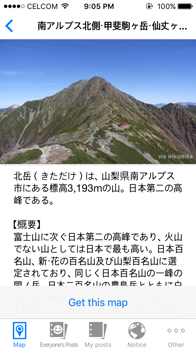

It is like a social media where you can like, or comment on other people's post. And since most users are Japanese, they use the native language in their post instead of English. Kind of struggle to understand, but you will get through it.


I don't think there's a limit on how many maps you can download. But like Mapple, you also have to pay especially if you want to unlock and use other functions offered for premium member. They offer premium membership up to a year. You can choose the one that suits your need. Once you have purchased the ticket, you can get access to topographical maps (in colors) and few more other functions.


You can check mine @ izzarosli (YAMAP app)
Labels: 10mountainsinjapan, hiking, itraveltohike, japan, map, misi2015, mountain, yamap