
Hello weirdo!

Random
Misi Gunung
List of mountains (DONE)
Trans Full C-Curve
#40mountainsin2018
#30mountainsin2017
#20mountainsin2016
#10mountainsinJapan
#10mountainsin2014
Links
Akmal | Ajiq
Julian.B | Kimmo.S
Tuesday, June 5, 2018, 5:50 PM
Trans Java Misadventure
An Introduction Won't Hurt

A wise man said, “Of all the books in the world, the best stories are found between the pages of your passport.” And I could not agree more.
I’ve been eyeing Indonesia (focusing on Java) as my next target for #10mountains mission right after I got back from Japan. It took me a year to prepare, from reading the trails of selected 10 mountains in Java, to finding guesthouses and outdoor shops nearby. I was pretty excited to begin the journey as this would be the longest backpacking journey I’ve ever done - a month. And because it was another 10 mountains mission after two years.
At first, I wanted to make it two months as I wasn’t confident enough to hike all 10 mountains within 30 days. I’ve prepared all the documents needed for visa application. But sadly, my documents weren’t good enough to convince them, so I had to proceed with Plan B, to hike in a month.
With everything’s packed and checked, then off I go.
But sometimes, hard work does not guarantee you a success. And who would have thought that the failure of my mission somehow turned into a great adventure that I could ever dream of.
To be continued….
Labels: 10mountains, indonesia, misigunung, mountain, outdoorwomen, transjava, transjavamisadventure, wanitagunung
Monday, November 20, 2017, 9:57 PM
#10mountainsin2014
- Gunung Bunga Buah, Genting Highland, Pahang (1,430 meter)
- Gunung Brinchang, Cameron Highland, Pahang (2,032 meter)
- Gunung Irau, Cameron Highland, Pahang (2,110 meter)
- Gunung Angsi, Kuala Pilah, Negeri Sembilan (825 meter)
- Gunung Berembun, Terengganu (1,108 meter)
- Gunung Merbabu, Indonesia (3,145 meter)
- Gunung Batur, Bali, Indonesia (1,7,17 meter)
- Gunung Tahan, Pahang (2,187 meter)
- Gunung Datuk, Rembau, Negeri Sembilan (885 meter)
- Gunung Kinabalu, Sabah (4,095 meter)
I have a therapist, her name is NATURE.
Labels: 10mountainsin2014, hiking, misi2014, misigunung, mountain, outdoorwomen, wanitagunung
Tuesday, October 17, 2017, 3:08 AM
To more mountains!
Gunung Malaysia
- Gunung Korbu, Perak (2,183 meter)
- Gunung Gayong, Perak (2,173 meter)
- Gunung Yong Belar, sempadan Perak, Pahang, Kelantan (2,181 meter)
- Gunung Junction, sempadan Perak, Pahang, Kelantan (2,072 meter)
- Gunung Tebu, Terengganu (1,039 meter)
- Gunung Tok Wan, Selangor (675 meter)
- Gunung Bunga Buah, Pahang (1,430 meter)
- Gunung Brinchang, Pahang (2,032 meter)
- Gunung Irau, Pahang (2,110 meter)
- Gunung Angsi, Negeri Sembilan (825 meter)
- Gunung Berembun, Terengganu (1108 meter)
- Gunung Tahan, Pahang (2,187 meter)
- Gunung Kinabalu, Sabah (4,095 meter)
- Gunung Jerai, Kedah (1,217 meter)
- Gunung Baling, Kedah (420 meter)
- Gunung Rabong, Kelantan (1,538 meter)
- Gunung GAP, Selangor (1,183 meter)
- Gunung Ulu Semangkok, Selangor (1,394 meter)
- Gunung Ledang, Johor (1,394 meter)
- Gunung Yong Yap, sempadan Perak/Kelantan (2,167 meter)
- Gunung Bubu, Perak (1,974 meter)
- Gunung Tok Nenek, Pahang (1,916 meter)
- Gunung Chamah, Kelantan (2,171 meter)
- Gunung Ulu Sepat, Perak (2,161 meter)
- Gunung Hitam, Selangor (1,220 meter)
- Gunung Bintang False, Perak (1,526 meter)
- Gunung Bintang Selatan, Perak (1,560 meter)
- Gunung Bintang, sempadan Kedah, Perak (1,862 meter)
- Gunung Bintang Utara, Kedah (1,835 meter)
- Gunung Berembun, Negeri Sembilan (1,014 meter)
- Gunung Besar Hantu, Negeri Sembilan (1,462 meter)
- Gunung Nuang, Selangor (1,493 meter)
- Gunung Inas, Perak (1,454 meter)
- Gunung Datuk, Negeri Sembilan (885 meter)
- Gunung Rembau, Negeri Sembilan (884 meter)
- Gunung Gagak, Negeri Sembilan (807 meter)
- Gunung Stong, Kelantan (1420 meter)
- Gunung Kob, Kelantan (1,240 meter)
- Gunung Baha, Kelantan (1,450 meter)
- Gunung Ayam, Kelantan (1,500 meter)
- Gunung Che Tahir, Kelantan (1,430 meter)
- Gunung Saji, Kelantan (1,285 meter)
- Gunung Tera, Kelantan (1,555 meter)
- Gunung Nyelit, Kelantan (1,345 meter)
- Gunung Beirut, Kelantan (1,380 meter)
- Gunung Bar Gading, Perak (1,620 meter)
- Gunung Bongkok, Perak (1,344 meter)
- Gunung Banlok, Perak (1,412 meter)
- Gunung Ulu Kinjor, Perak (1,232 meter)
- Gunung Guling Gantang, Pahang (800 meter)
- Gunung Sempah, Pahang (1,205 meter)
- Gunung Rajah, Pahang (1,683 meter)
- Gunung Liang Timur (1,933 meter)
- Gunung Liang Barat (1,933 meter)
- Gunung Tumang Batak (1,933 meter)
- Gunung Chondong Geliting (1,825 meter)
- Gunung Kerjul, Ulu Slim, Perak (1,496 meter)
- Gunung Sanggul, Ulu Slim, Perak (1,451 meter)
- Gunung Tampin, Tampin, Negeri Sembilan (764 meter)
- Gunung Tampin Selatan, Negeri Sembilan (734 meter)
- Gunung Hulu Lenik, Kuala Kubu Baru, Selangor (1,150 meter)
- Gunung Kecil Hantu, Jelebu, Negeri Sembilan (1,354 meter)
- Gunung Hantu, Jelebu, Negeri Sembilan (1,241 meter)
- Gunung Gua Rimau, Kluang, Johor (889 meter)
- Gunung Belumut, Kluang, Johor (1,010 meter)
- Gunung Chemendong, Kluang, Johor (846 meter)
- Gunung Gapis, Raub, Pahang (1,106 meter)
- Gunung Jua, Raub, Pahang (830 meter)
- Gunung Tui, Raub, Pahang (1,397 meter)
- Gunung Kerunai, Gerik, Pahang (1,000 meter)
- Gunung Kenderung, Gerik, Pahang (1,223 meter)
- Gunung Behrang, Behrang, Perak (1,500 meter)
- Gunung Putung Asap, Kuala Kangsar, Perak
- Gunung Bubu West, Kuala Kangsar, Perak (1,647 meter)
- Gunung Bubu, Kuala Kangsar, Perak (1,568 meter)
- Gunung Shoid, Gua Musang, Kelantan (1,947 meter)
- Gunung Gerah, Perak/Kelantan (2,103 meter)
- Gunung Bilah, Perak/Kelantan (2,077 meter)
- Gunung Surian, Perak (1,827 meter)
- Gunung Kuar, Perak (1,772 meter)
- Gunung Aler, Perak (1,779 meter)
- Gunung Berhid, (1,930 meter)
- Gunung Charlie, Pahang/Perak (1,923 meter)
- Gunung 3 Boundaries, Perak/Pahang/Kelantan (1,805 meter)
- Gunung 6040, Pahang (1,840 meter)
- Gunung Anak Noring, Kelantan (1,889 meter)
- Gunung Noring Timur, Kelantan (1,861 meter)
- Gunung Suku, Cameron Highland, Perak (1,797 meter)
- Gunung Yellow, Cameron Highland, Perak (1,667 meter)
- Gunung Pass, Cameron Highland, Perak (1,587 meter)
- Gunung Bunting, Cameron Highland, Perak (1,240 meter)
- Gunung Tanggung, Cameron Highland, Perak (1,270 meter)
- Gunung Gandik, Cameron Highland, Perak (1,291 meter)
- Gunung Pasir, Seri Menanti, Negeri Sembilan (892 meter)
- Gunung Pulai, Kulai, Johor (654 meter)
- Gunung Lambak, Kluang, Johor (510 meter)
- Gunung Pulai, Baling, Kedah (620 meter)
- Gunung Mat Chinchang, Langkawi, Kedah (701 meter)
- Gunung Raya, Langkawi, Kedah (881 meter)
- Gunung Semanggol, Kerian, Perak (390 meter)
- Gunung Kuang, Kuah, Langkawi (420 meter)
- Gunung Perlis, Perlis (733 meter)
- Gunung Arong, Mersing, Johor (240 meter)
- Gunung Alai, Gerik, Perak (791 meter)
- Gunung Papulut, Gerik, Perak (726 meter)
- Gunung Pulut, Gerik, Perak (651 meter)
- Gunung Lentang Legong, Hulu Langat, Selangor (1370 meter)
- Gunung Berembun, Cameron Highland, Pahang (1840 meter)
- Gunung Peninjau, Ipoh, Perak (1058 meter)
- Gunung Jasar, Cameron Highland, Pahang (1,704 meter)
- Gunung Perdah, Cameron Highland, Pahang (1,576 meter)
- Gunung Ruil, Cameron Highland, Pahang (1,718 meter)
- Gunung Telapak Buruk, Negeri Sembilan (1,193 meter)
- Gunung Keriang, Alor Setar, Kedah (217.9 meter)
- Gunung Kerengga, Pedu, Kedah (243 meter)
- Gunung Bubu, Gerik, Perak (619 meter)
- Gunung Pupuk, Gerik, Perak (400 meter)
- Gunung Basor, Jeli, Kelantan (1,840 meter)
- Gunung Kasai, Kelantan (1,223 meter)
- Gunung Siring, Kelantan (1,704 meter)
Gunung Indonesia
- Gunung Rinjani, Lombok (3,726 meter)
- Gunung Batur, Bali (1,717 meter)
- Gunung Merapi, Yogyakarta (2,930 meter)
- Gunung Merbabu, Yogyakarta (3,145 meter)
- Gunung Ceremai, Kuningan (3,078 meter)
- Gunung Argopuro, perbatasan Probolinggo, Situbondo, Bondowoso (3,088 meter)
Gunung Jepun
- Gunung Io, Nagano (9,055 kaki / 2,760 meter)
- Gunung Tsukuba, Tsukuba (2,877 kaki / 877 meter)
- Gunung Kita, Yamanashi (10,476 kaki / 3,193 meter)
- Gunung Nakashirane, Yamanashi (10,022 kaki / 3,055 meter)
- Gunung Aino, sempadan Shizoaka, Yamanashi (10,463 kaki / 3, 189 meter)
- Gunung Takao, Tokyo (1,965 kaki / 599 meter)
- Gunung Kobotoke-Shiroyama, Tokyo (2,198 kaki / 670 meter)
- Gunung Kagenobu, Tokyo (2,385 kaki / 727 meter)
- Gunung Jinba, Tokyo (2,812 kaki / 857 meter)
- Gunung Fuji, sempadan Shizoaka, Yamanashi (12,388 kaki / 3,776 meter)
Gunung Thailand
- Gunung Silipat, Betong (1,991 kaki / 607 meter)
P/S: This list will be updated from time to time. Till then, see you when I see you on track :)
The last word always belongs to the mountain.
Labels: hiking, indonesia, itraveltohike, japan, misigunung, mountain, outdoorwomen, wanitagunung
3:04 AM
#20mountainsin2016 (updated)
Since I'm stuck with Japan posts, I'll update on my #misigunung #misi2016 's progress here.
1. Mount Baling, Baling, Kedah (420m / 1377ft)
2. Mount Rabong, Gua Musang, Kelantan (1538m / 5047ft)
3. Mount GAP, Fraser Hill, Kuala Kubu Bharu, Selangor (1183m / 3868ft)
4. Mount Ulu Semangkok, Fraser Hill, Kuala Kubu Bharu, Selangor (1394m / 4558ft)
5. Mount Datuk, Rembau, Negeri Sembilan (885m / 2900ft)
6. Mount Ledang, Ledang, Johor (1276m / 4186ft)
7. Mount Yong Yap, Perak (2168m / 7110ft)
8. Mount Bubu, Perak (1657m / 6476ft)
9. Mount Tok Nenek, Perak (1916m / 6248ft)
10. Mount Chamah, Kelantan (2171m / 7123ft)
11. Mount Ulu Sepat, Perak/Kelantan (2161m / 7089ft)
12. Mount Black, Hulu Langat, Selangor (1220m / 4026ft)
13. Mount Bintang False, Perak (1526m / 5007ft)
14. Mount Bintang South, Perak (1560m / 5118ft)
15. Mount Bintang, Kedah/Perak (
16. Mount Bintang North, (1862m / 6020ft)
17. Mount Berembun, Negeri Sembilan (1014m / 3326ft)
18. Mount Besar Hantu, Negeri Sembilan (1462m / 4796ft)
19. Mount Nuang, Selangor (1493m / 4898ft)
20. Mount Stong, Kelantan (1422m / 4665ft)
11 mountains completed. Another 9 mountains to go!
**update : Completed all 20 mountains last year. Yeayyyyyy!
It was in those moments of loneliness that I found You.
Labels: 20mountainsin2016, hiking, malaysia, misi2016, misigunung, mountain
Sunday, September 24, 2017, 10:22 AM
Done and dusted!
Finally completed the #10mountainsinJapan post after 2 years. haha. Hopefully it gives you some ideas and insights on how it would be like to hike in Japan. I will probably make a Malay version of my journey in another website (still working on it, which I don't know how long will it takes. haha). #survivingJapan trip taught me a lot. It left me speechless and turned me into a story-teller. I wish to go further and discover more, especially on mountains and culture parts.
So if you have any questions or inquiries regarding #10mountainsinJapan, feel free to ask, hit up the comment button. I don't eat people :)
Misadventure in Indonesia coming up next!
Labels: 10mountainsinjapan, itraveltohike, japan, misigunung
Friday, September 22, 2017, 5:26 PM
10. Mount Fuji
They said "save the best for the last".

Mount Fuji (富士山) or Fuji-yama or Fuji-san is the
tallest (3,776m) and the most famous mountain in Japan. It is an icon, a proud
of Japanese people. Stands on the border between Yamanashi and Shizouka
prefecture, Fuji-san is also known as a sacred mountain, a part of Three Holy
Mountains of Japan and listed as one of the ultra-prominent peaks (with
topographic prominence greater than 1,500 metres).


The official climbing season for Mount Fuji only open on
summer which starts from early July to mid September. On other season, the
mountain is capped with snow and not many mountain huts are operating/open, so
hikers especially beginner are not advised to hike.
Mount Fuji has 4 different trails to the peak :-
- Yoshida Trail (Fuji Subaru Line)
- Subashiri Trail
- Gotemba Trail
- Fujinomiya Trail

I was supposed to hike with the Malaysian team (refer to my Minami Alps post), but due to bad weather (thypoon to be exact), I pulled out from the trip last minute and planned my own trip with another friend of mine who did not manage to summit the other day.
We chose to use the easiest and the most popular trail, Yoshida trail. So we decided to take the highway bus straight from Shinjuku
to Fuji 5th station, but unfortunately it was sold out a day before (so fast!).
But worry not, we found other alternative, by train.
 |
| Nah... not this. This is a luxury one. |
 |
| This one. |
Nakano Station – Shinjuku Station - Otsuki (JR Limited Express train (Azusa or Kaiji)) – Kawaguchiko Station (Fujikyuko Railway) – Fuji 5th Station (bus in front Kawaguchiko Station)
We reached 5th Station by 5.54pm (Japan time) when the sun
just about to set. We took some time to enjoy the scenery, packed our bags and
used the toilet (it’s free here at 5th station). We started hiking around
6pm-ish. There is no permit fee for Mount Fuji, but there is conservation
donation about 1000yen (optional). I donated and received few pamphlets on
Fuji, a batch and wifi password (yes! there is wifi at Mount Fuji, all the way
from 5th station to the peak).


The weather was nice but cold. As we hiked further, it got colder and darker. And to be honest, cold weather is my weakness. We
stopped at each station, catching breath and trying to collect thoughts
(because coldness made us lost our mind).
I hit my limit at 7th Station. I could not comprehend the coldness (emergency blanket failed to keep me warm) and decided to sleep in the hut to recover. Afraid that if I proceed I might get hypothermia. The weather was no joke, freaking cold. It was 9°C at that night and they said it might drop to zero in the morning. My friend, however, continued the hike as he really wanted to witness the sunrise from the peak. I bid him goodbye and went to sleep right away.
I woke up in the morning feeling all fresh (the mattress was very comfortable. of course la best, I paid 5500yen for it). I went out and saw many hikers outside and on the trail. The scenery and sunrise were amazing. I bet it looks spectacular up there, on the peak. But never mind, there is always next time.
I continued my hike around 6AM-ish. It was less cold, but the trail was packed with hikers and there were long queue until the peak.

I stopped at 8.5th station for toilet and stupidly left my hat there and I proceeded the journey while cursing at my stupidity along the way. Haha.

I woke up in the morning feeling all fresh (the mattress was very comfortable. of course la best, I paid 5500yen for it). I went out and saw many hikers outside and on the trail. The scenery and sunrise were amazing. I bet it looks spectacular up there, on the peak. But never mind, there is always next time.
I continued my hike around 6AM-ish. It was less cold, but the trail was packed with hikers and there were long queue until the peak.

I stopped at 8.5th station for toilet and stupidly left my hat there and I proceeded the journey while cursing at my stupidity along the way. Haha.

 |
| Where I stupidly left my hat. |


I reached the top around 11AM-ish (Japan time).
 |
| When you asked other people to take your picture but you cannot complain. Haha. |
There were temple and few shops on top. Also, an excavator.


I walked around the crater rim and saw a long queue of hikers waiting for their turn to take picture at the highest point of Mount Fuji.

After few minutes of walking, I decided to descend as I had bus to catch! I hurriedly went down. The descend trail has many zig-zags (about 23-24) and that took me about 3 hours to reach the trail head. Thank God, I got there on time and took the last bus to Kawaguchiko train station.


While I was on the bus I met a Germany trail runner who is currently staying in Japan for work and has been to Mount Fuji for 49th times the moment we spoke. He said Mount Fuji is a training ground for many trail runners, including him. Our conversation was mostly covered on mountains. He told me about UTMF while I told him about mountains in Malaysia and why he should sign up for Kinabalu Climbathon.
We parted ways once we reached the train station. It was nice to speak to another stranger in another country (actually it was more to feeling grateful that I finally met someone who can speak English.haha). I went to Tokyo with a happy feeling knowing that I completed my #10mountainsinJapan mission successfully. Alhamdulillah. Yeay!

Labels: 10mountainsinjapan, fuji, itraveltohike, japan, misi2015, misigunung
Monday, April 10, 2017, 8:28 PM
2. Mount Tsukuba (筑波山), Ibaraki
Mount Tsukuba was considered as my impromptu plan. I was supposed to hike Mount Io and Mount Aka at Yatsugatake. But due to unpredictable weather and strong wind, I could not proceed to Mount Aka. So I had to come up with a new plan right away.
I discussed with Sota-san about this mountain over dinner after we got back from Mount Io. I was hesitated at first because I didn't have anyone to accompany me. However, later, I was suddenly overflowed with confidence and bravery (that I didn't know where it came from) and decided to go for an easy hike the moment I woke up the next morning despite not having a buddy to go with.
Located in Ibaraki prefecture, near the Tsukuba city, Mount Tsukuba / 筑波山 / Tsukuba-san (877m/2900ft) is a well-known mountain for its’ double peaks, Nyotai-san (877m) and Nantai-san (871m) as well as the ancient shrine that is located at the foot of the mountain.


The shrine at Mount Tsukuba's base is among the oldest Shinto shrines in Japan and the mountain has been worshiped by the Japanese for over 3000 years as it is believed can bring them happiness and prosperity.


In Japanese folk cosmology, Nyotai-san means “Woman’s Body Mountain” while Nantai-san means “Man’s Body Mountain”, both represent Izanami and Izanagi, the nation’s first conjugial pair and creator deities, respectively.
Mount Tsukuba is listed in '100 Famous Mountains in Japan' written by an author and climber Kyuka Fukada. This list is famous among Japanese hikers and can be said as one of the ultimate goals for them to complete.
It took me about one hour and a half to reach Tsukuba from Nakano. Then, from Tsukuba train station, I took a bus ride to Tsukuba Jinja. The mountain trail is located behind the shrine. There are few trails that hikers can try, Miyukigahara trail, Shirakumobashi trail, Mukaeba trail, Otatsu-ishi trail, Shizen-kenkyuro trail, Sancho-renrakuro trail. (english.ibarakiguide.jp/news/climbing-mt-tsukuba.html). You can get the trail map at Information Office near the entrance. They also provide locker service.


I used Miyukigahara trail for ascend and Shirakumonbashi trail for descend. It is better to use different trail for both ascend and descend as you can get to experience different side of the mountain, as told by Sato-san. Hehe.


It took about 1 hour and 30 minutes to reach Nyotai-san using Miyukigahara trail. The trail was not that hard despite the never ending stairs. It was clear and clean, as expected. One won’t simply get lost during hiking. But even so, always aware of surrounding and take precaution. I also met many friendly hikers on the trail and I like how they kept cheering me along the journey.


Sadly, the fog was too much that it covered most of the view. So there was no view for me this time too. I had my light lunch to recover my energy and walking around a bit taking photo despite the view. There's also few shops on top of this mountains selling food and souvenirs.
I continued my journey to the second peak, Nantai-san.


There’s another way to go to the mountain top without hiking, Mount Tsukuba also offers cable car service until Nyotai-san peak. And from there you can walk about 15 minutes to the other peak, Nantai-san.

I gotta say that Nantai-san peak looks more or less like Mount Datuk in Malaysia. The peak consists of rock. Most mountains in Japan are volcanic, but Mount Tsukuba is composed of non-volcanic rocks such as granite and gabbro.


There was a small shrine on top of Nantai-san. The hikers took their time to pray here. And there was a view as well! Thank God, finally! I wandering around, taking photo (as usual), observing other hikers (because I was alone and didn’t know how to initiate conversation because my Japanese was bad haha). When I was busy selfie-ing, came this one uncle offered to help me taking my photo (I bet he saw my struggle coz I didn’t use monopod whatsoever). I gladly accepted his help and I returned the favor by taking photo of him and his family.


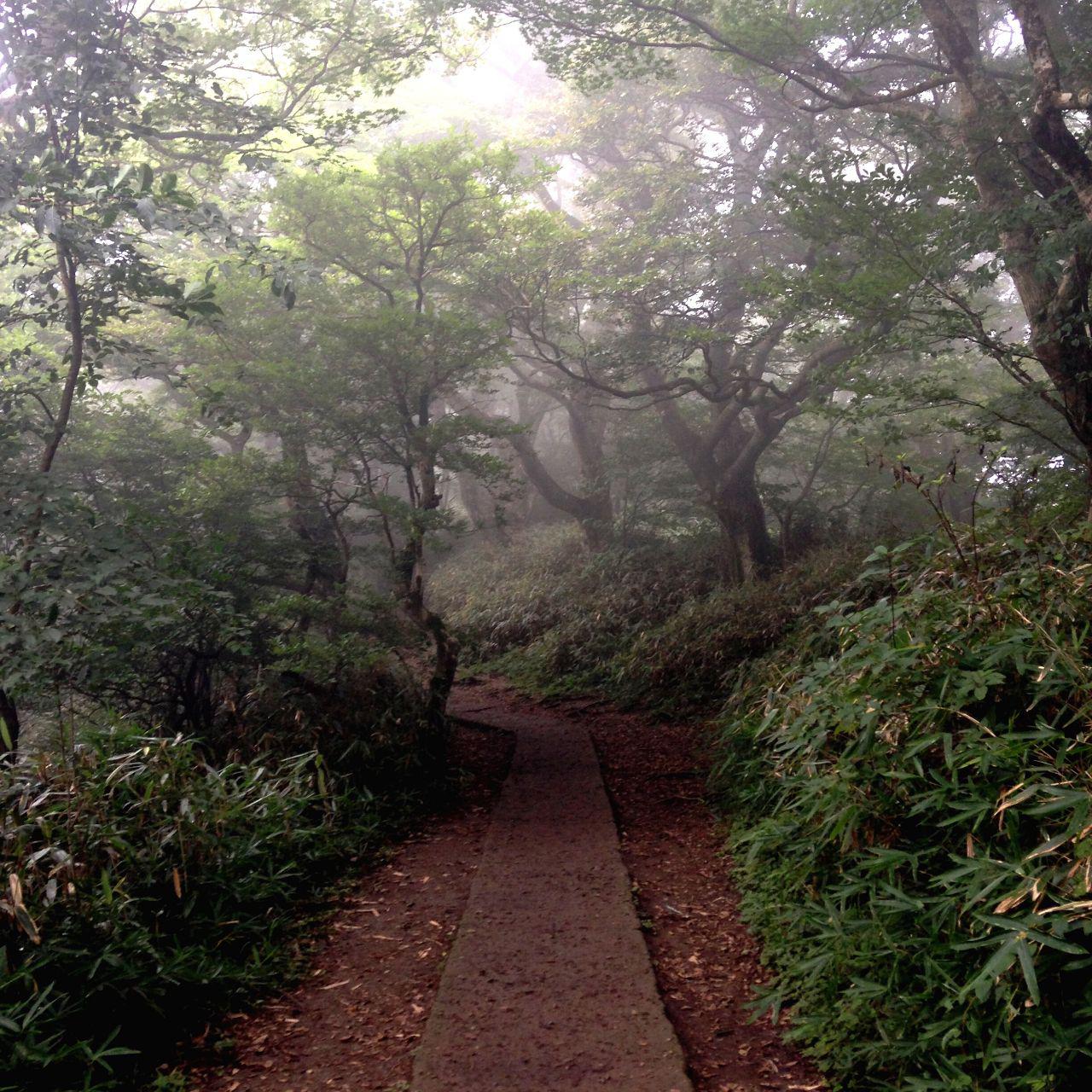
I spent few minutes enjoying the view before decided to go down. And I’m following Sota-san’s advise, to use another route which is Shirakumobashi trail. It took me about 40-50 minutes to reach the trail head. I was literally running down because the forest looked creepy to me. Haha. And there were also many memorial stones (or whatever it’s called) along the trail which added up to its creepiness level. Haha.




I met a group of trail runners training for their next running event near the trail head. They were funny, friendly and bright (I mean their running apparels). I had small conversation with them and we took picture together before parting our ways. I went straight to the shrine and wandering around a little bit before heading back to the bus station.


While waiting for the bus, I had conversation with this one Japanese man who happened to be a lecturer in one of the local university. He was amazed seeing me hiking the mountain alone as most tourists/hikers prefer to go to Fuji instead of Tsukuba. Somehow I understand that. Fuji is the tallest and the most famous mountain in Japan, of course it becomes tourists' number one's choice. As for me, I don't really mind. As long as it's a mountain, I will climb 'em all! Hehe.
As soon as I reached Tsukuba city, I rushed to the toilet to change my clothes as I couldn't find toilet near the shrine. Coincidentally, the city was having Summer Festival (or known as Matsuri) and there were many booths and stalls selling foods and souvenir. This was my first time attending Japanese festival. I was all excited and amazed. Again, I was being 'jakun'. Haha.


There were drum performance, Noh theater, Japanese traditional dance. It was fun watching all those in real life as I always have a thing on traditional stuff. I enjoyed the festival for few more hours and went back to Nakano at night.
p/s : sorry for the bad photography skill. -__-"
Labels: 10mountainsinjapan, itraveltohike, japan, matsuri, misi2015, misigunung, tsukuba